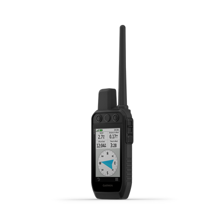
Garmin, Alpha 300 Handheld Only
If you're a hunter who wants to track and train your dogs in rugged environments - look no further. With an improved touchscreen display and up to a 2.50-second update rate, this durable handheld makes it easy to lead your pack and monitor up to 20 dogs from up to 9 miles away. The training functions use a simple, button-operated design - providing 18 levels of stimulation, tone, or vibration when paired with your training-enabled collar. Additional features such as the new Channel View, Backup and Restore, and Outdoor Maps+ availability are designed to help you on every hunt.
STRONG CONNECTION. STRONG BOND.
Sagebrush plateaus, rolling prairies, dense hardwoods, rocky ridges — no matter where you hunt, you and your dogs need reliable gear. Track and train your dogs in the field1 with the Alpha 300 handheld, featuring a new vivid 3.5” touchscreen and user-friendly 6-button design.
INTERACT WITH A RESPONSIVE TOUCHSCREEN AND BUTTONS.TRACK AND TRAIN YOUR PACK IN THE FIELD1.
THE USER-REPLACEABLE BATTERY LASTS UP TO 55 HOURS.
NAVIGATE WITH TOPOACTIVE MAPS AND DOWNLOADABLE SATELLITE IMAGERY.
TRAIN YOUR PACK
Use dedicated buttons for fast training cues and command initiation. Select from 18 levels of momentary and continuous stimulation. Hunters can also issue different levels of audible tone or vibration commands1.
HUNT METRICSSee critical hunt metrics, such as distance, speed and time afield, right on the dog info screen1.
SATELLITE IMAGERYDownload satellite imagery via Wi-Fi® technology to your device, and see the terrain features from above to help you navigate or find suitable habitat for your quarry.
HANDHELD FEATURES
LONG-LASTING BATTERY
The user-replaceable battery lasts up to 55 hours.
GROUP MANAGEMENT
Save time at the start of every hunt with groups of dogs and people that match how and whom you hunt with.
MONITOR THE HUNT
See when a dog is “treed” or “on point.”
GARMIN EXPLORE™ APP
Pair with the Garmin Explore smartphone app to review the entire hunt and more.
BACKWARD COMPATIBLE
Easily pair the handheld to select T and TT™ series collars.
DOG LIST
Store up to 250 dogs, making it easy to switch active collars in the field.
NAVIGATION FEATURES
MULTI-GNSS SUPPORT
Access multiple global navigation satellite systems for better service in challenging environments.
PRO VIEW COMPASS
This simple, at-a-glance tracking shows which direction and how far away your dogs are.
TOPOACTIVE MAPS
Get detailed views of terrain contours, topographic elevations, summits, parks and more.
PREMIUM MAP FEATURES
Subscribe to Outdoor Maps+, and get public land information, enhanced topographic maps, landowner names and more.
ALTIMETER
The barometric altimeter helps you accurately monitor ascent and descent.
3-AXIS COMPASS
Navigate with the tilt-compensated 3-axis electronic compass — whether you’re moving or not.
1 Requires compatible dog collars (sold separately)
IN THE BOX -
Alpha 300 handheld with rechargeable lithium-ion battery pack
Belt clip
AC adapter
USB-C cable
Documentation
NEW HANDHELD FEATURES
- IMPROVED BATTERY LIFE - The user-replaceable battery lasts up to 55 hours or up to 50 hours with inReach satellite technology - so don't worry about running out of power before your dog does.
- NEW BRIGHTER DISPLAY - The Alpha 300 Series features a new vivid sunlight-readable 3.5" capacitive touchscreen display and a button operated, dog-focused design - allowing for quick, minor adjustments in the field.
- NEW CHANNEL VIEW - monitor the concentration of collars in the area, and easily select less congested channels to avoid interference.
- NEW BACKUP AND RESTORE - Keep your data secure and protected by creating backups on your Alpha 300 Series handheld device.
- NEW PREMIUM MAP FEATURE - Subscribe to Outdoor Maps+ and get public land information, enhanced topographic maps, land owner names and more. Regularly updated content is wirelessly delivered directly to your compatible handheld via Wi-Fi technology.
- PREMIUM NAVIGATION FEATURES - Preloaded TopoActive maps, downloadable satellite imagery, and a built-in 3-axis compass & barometric altimeter help you navigate with ease.
Field performance hinges on simple control, reliable power, and clear situational data. The Alpha 300 supports tracking and training up to 20 dogs at distances up to 9 miles, enabling quick regrouping in dense cover or on open ground. Channel View helps avoid interference by selecting less congested channels when multiple collars operate nearby. Backup and Restore protects field data so training notes and dog lists stay accessible after a device reset or replacement. The user-replaceable battery supports long days afield, with up to 55 hours of operation and about 50 hours when using inReach satellite connectivity. Satellite imagery and TopoActive maps can be downloaded to plan hunts and identify habitat features from above. Preloaded TopoActive maps, downloadable satellite imagery, a 3-axis compass, and a barometric altimeter aid navigation in challenging terrain. The dog list can store up to 250 dogs, enabling quick collar switching during group hunts or field trials. Pairing with the Garmin Explore app lets you review the entire hunt and adjust training plans. Regular care and data management keep the device ready for the next field session.
Garmin, Alpha 300 Handheld Only Q&A
How long does the Alpha 300 battery last, and is there a difference when using inReach?
The battery lasts up to 55 hours; with inReach satellite technology, about 50 hours. To maximize life, keep contacts clean and avoid extreme temperatures.
How many dogs can be tracked at once with the Alpha 300?
Track and train up to 20 dogs from up to 9 miles away (requires compatible dog collars). This setup supports quick regrouping in varied terrain.
What training options are available on the handheld?
There are 18 levels of momentary and continuous stimulation, plus audible tone or vibration commands. The controls use dedicated buttons for rapid cue delivery.
What is the best way to view hunt metrics during field work?
The dog info screen shows distance, speed, and time afield. These metrics help monitor pace during upland drives and water work.
Can I access satellite imagery and premium maps on the Alpha 300?
Yes; you can download satellite imagery via Wi‑Fi and subscribe to Outdoor Maps+ for enhanced maps.
How does the Dog List and Group Management function help in field sessions?
The Dog List stores up to 250 dogs, and Group Management saves matches of dogs and people for the hunt.
What safety-focused navigation features does the device provide?
A built‑in 3‑axis compass and barometric altimeter aid navigation in rugged terrain. The device supports rapid, button-based cues for training.
What does Backup and Restore do for field data?
Backup and Restore keeps field data secure and recoverable if the device is reset or replaced. This ensures training notes and dog lists stay accessible.